
Ever fancy getting out of town and hitting the open road? Well, this one might take you a little while. The series of roads that form the Pan-American highway span 14 countries and 19,000 miles (if you take the direct route) running from the north shore of Alaska to the southern tip of Argentina.
This is the remarkable journey across both American continents.
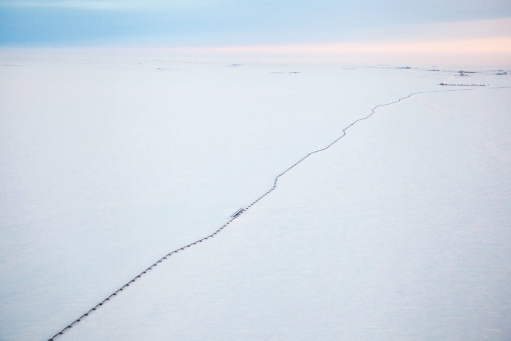
Prudhoe Bay is an isolated, freezing little village of just 1,300 permanent residents. It is part of the North Slope Borough, the northernmost region in Alaska and, therefore, the northernmost region in the United States. The Trans Alaska Oil Pipeline begins here, meaning most visitors to Prudhoe Bay are workers heading to town for jobs on the pipeline or on its vast oil field, but there is also a small tourism industry. Prudhoe Bay is the origin (or terminus, depending on which you’re traveling) of the Pan-American Highway.
Read More: Alert | The northernmost inhabited place in the world
The road promptly leaves Purhdoe Bay and crosses a mountain range and the Gates of the Arctic National Park and Reserve. Via Fairbanks, in southern Alaska, you head down into Canada and soon after passing through Whitehorse, you have the first of many choices on quite which Pan-American route you wish to take: either down through British Columbia, or over to the territory of Alberta, and passing through Edmonton and Calgary.
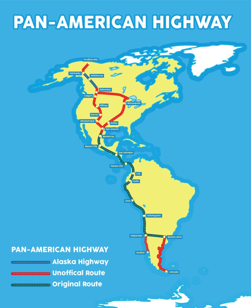
The Land of the Free awaits and road-trippers here have plenty of choice over which way they will navigate their journey. Any interstate highway is classified as the Pan-American Highway by the US federal government (meaning you could just hug the West Coast if you really wanted to), but purists will make their way towards southern Texas and the border town of Laredo, the spiritual home of the original Pan-American Highway.
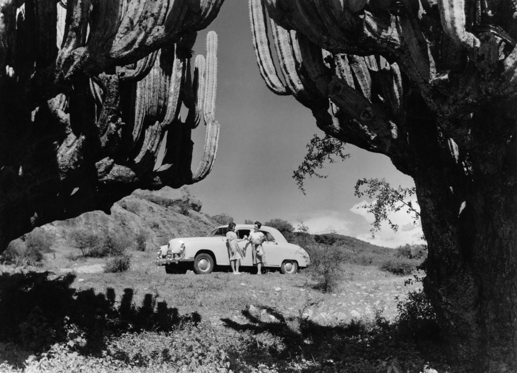
It was the road from Laredo to Mexico City that was the original idea and construction for a transcontinental highway. It is here that Jack Kerouac crossed into Mexico in On The Road, perhaps the most famous road-trip novel in history, and it is along the road to the Mexican capital that his breakneck adventure with Dean Moriarty finally loses control.
The Pan-American Highway, however, is still only approaching the halfway point. The capitals of Guatemala, El Salvador, Nicaragua, Costa Rica and Panama are all on the route through Central America, until the road finally runs out.
The mountainous jungle that separates Panama from Colombia is called the Darien Gap. No road traverses this region, a barrier between north and south that remains unpassable by tarmac due to cost, environment and opposition from locals in the area. Increasingly, northward-bound migrants are choosing to cross the region by foot and it has been driven in off-road vehicles and motorcycles, but its swamplands, lawlessness, presence of guerilla fighters and isolation from emergency services make it an incredibly dangerous journey. In total, the break in the Pan-American Highway measures just 60 miles, but it seems to represent a wider void, as you leave the northern continent behind.
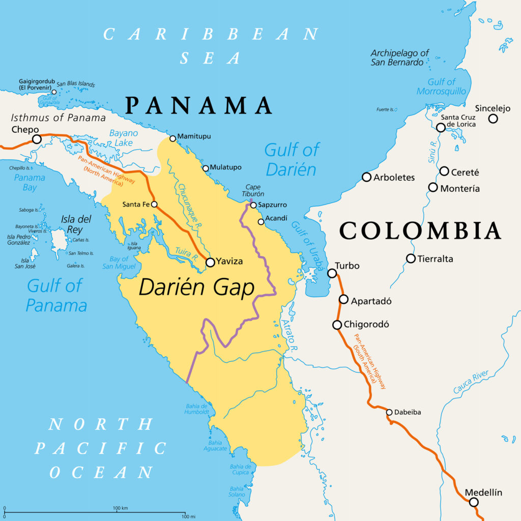
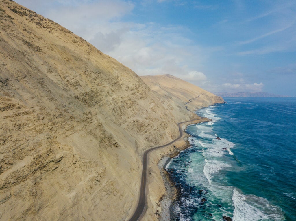
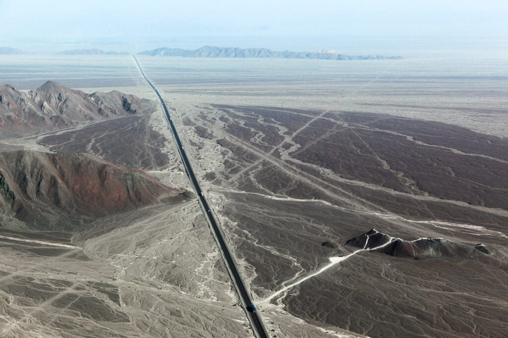
A ferry to Turbo, Colombia, is the most common means for crossing the Darien Gap and is where the Pan-American Highway again begins. The road hugs the west coast of the South American continent, sticking to the west of the Andes Mountains as it travels through Colombia, Ecuador, Peru and Chile.
Just north of the Chilean capital city of Santiago, you can pick up a road to Argentina; once over the border this becomes the Argentina National Route 7 and leads right across the width of the nation to its capital, Buenos Aires. Though not the most direct route to the very bottom of the continent, the original Pan-American Highway ran from Laredo to Buenos Aires, and therefore it is a key destination on the journey.
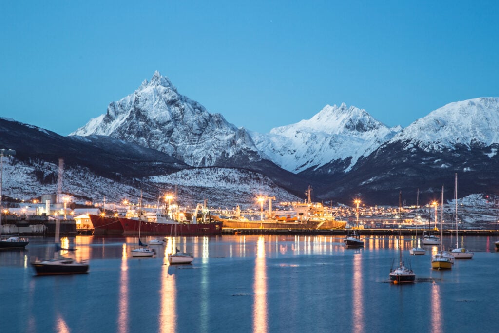
You can, from Buenos Aires, cross into Uruguay with the road network then leading into Brazil and up to Rio De Janeiro. Alternatively, if you want to head down to the southern tip of Argentina and the very end of the Pan-American Highway, there awaits a breathtaking final stint through Patagonia to the island of Tierra Del Fuego, where the city of Ushuaia marks an end to this mammoth journey.
Though not a singular route, the cross-country, cross-continent network totals over 30,000 miles, making it the longest (unofficial) road in the world. If that’s not what purists among you are after, the longest unbroken road in the world is Australia’s Highway One, or “The Big Lap”.
But that’s a Great Big Story for another day…